Boat Ride Off Bay Bulls

Saturday we drove down to Bay Bulls to catch a tour boat to see puffins, other sea birds and, if lucky, whales.  Bay Bulls is the little town where I stayed for 6 weeks or so back in 1972.  For some reason there was no sign of the old wooden house where we stayed, perhaps because it had no electricity, running water or central heating.  It was hard to even tell where the old house had been with a nicely paved road extending far beyond where the old muffler-busting gravel road petered out in the old days, just beyond the old house.  All in all the town is entirely different than the impoverished fishing village I remembered, which is a good thing.

We have a fair number of pictures but we were not sure how many puffins and sea gulls you wanted to see so we present only a few of them here.

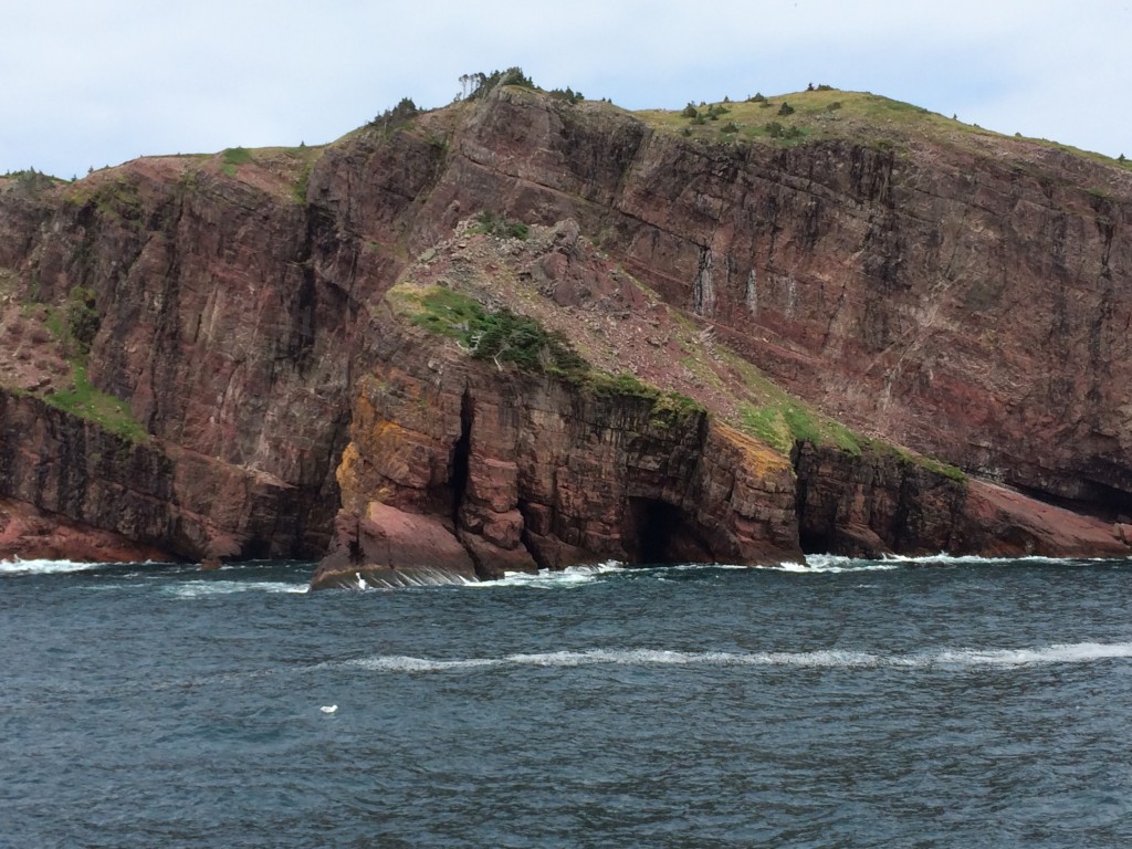
The trip out was nice once I convinced myself I wouldn’t be sea-sick.  Below are several pictures of the outer-bay and around to the open-ocean shore.  Later today we will head out for a 4+ mile walk around from Bay Bulls to Witless Bay (the next bay to the north) so you’ll get more picks of Bay Bulls and the sea around there.

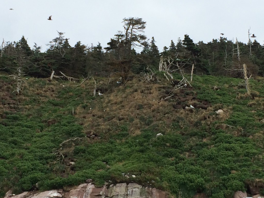
Then the boat headed out to the larger of several islands that are designated by the Canadian government as a bird sanctuary (“Witless Bay Ecological Reserve”).

So this is a puffin.  Not sure what all the excitement is about, except maybe they make for cute pictures, toys and stuffed animals.  They mate for life but live apart most of the year and only have 18 seconds of sex per year and that’s underwater.  The tour guide says they are a member of a class of birds called PPF – piss poor flyers but he’s a Newfie and admitted that some of this information might not be scientifically reliable.  Poor swimmers the puffin might be but using their aerodynamically-challenged wings they can dive down to 100 feet to catch a sadly small fish.

Government scientists at work in a bird blind…
Why does this picture remind me of Monty Python?

More on this bird sanctuary with a decent puffin picture:
http://www.env.gov.nl.ca/env/parks/wer/r_wbe/

You-tube video – this is likely taken from the same tour boat:
https://www.youtube.com/watch?v=uAN-oyqY0QE

The tour guides were very happy to find a couple whales so late in the season since by mid-August the whales usually come to the realization that the water is much warmer in the Caribbean.  Of course the tour company did not emphasize the scarcity of whales prior to our signing up but there were still a few left and we found two of them.  They didn’t dance around much for us so not a lot of pictures but this was pretty well the best of the lot.

IMG_0367-1024x634

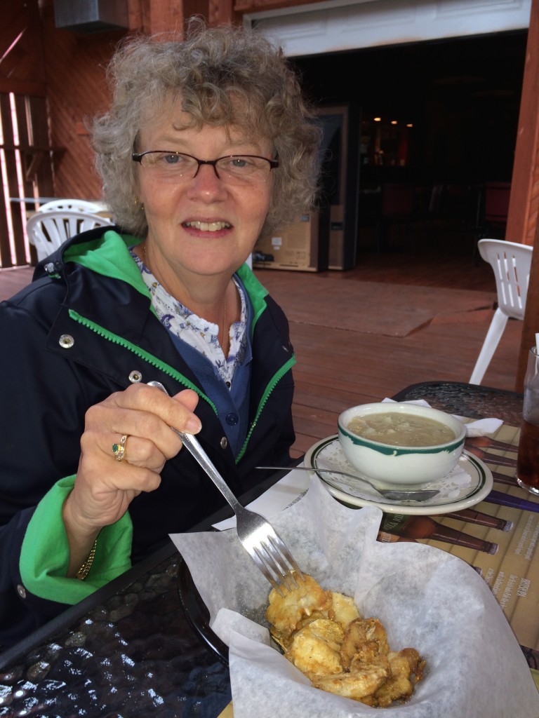
Keeping in the spirit of the sea we found a small restaurant with fish chowder and cod tongues.  (Greg, you wanted more food pics so this is for you).  Janet felt sort of bad that these cod could no longer talk with each other but the tongues were pretty tasty…
Friday’s Two Hikes

First, a Walk Up Signal Hill…

On Friday we went up Signal Hill and around the area.  Signal Hill has about as much history as the harbour.  If the harbour has a narrow entrance and is easily defended, the cannons shown here along with the cable across the entrance were the mechanisms of that defense.  For my fellow Hornblower fans, I kept thinking that in the face of such defense, our Captain would put ashore before dawn and tell his boys to use nothing but cold steel until they controlled the heights.  Easier said than done.

Also of historic importance was Marconi’s receipt of the first trans-Atlantic radio signal, as highlighted below.

We suggest you take two minutes at http://en.wikipedia.org/wiki/Signal_Hill,_St._John’s to get more context.

Looking down toward town on our ascent

Looking up toward Cabot Tower.  We will give you several shots as we ascend

These blueberries disappeared within 20 seconds of this photo being taken.  Like the ones we had for breakfast in Maine they were delicious, so much so that we stopped at the local Dominion to get some.  Janet refused to buy the ones sold there however as they were grown in British Colombia!
~
This is one of the oil-platform supply ships that had been parked in front of our hotel window.  We’ll follow it’s progress through the day
 ~


Breezy gal above the narrows

~

The right, outside point of the Narrows, coming out from St. John’s Harbour

~

Working the artillery pieces
~
Our supply ship safely get’s past the guns
~
Getting closer to Cabot’s Tower
~
Outside Cabot’s Tower
~
 Inside Cabot’s Tower
 
Yes, signal flags of course
~
Looking toward town from inside the Tower
~
 Looking north from atop the Tower
~
St. John’s from atop the Tower
~
Looking south to the entry into the Narrows from atop the Tower
~
Noon approaches and we learn that “mad dogs” dwell not only in Hong Kong

 …and then on to Cape Spear:

Please ignore the fact that my iPhone sometimes shifts into new settings, such as black white, without warning, and no, we’re not trying to be artsy.

~

So how in this picture is Janet distinct from the other 300 million or so folks in North America?Standing in this corner near the water at a longitude of 52 37′ 26” she is further east than all of them.  (And let’s not quibble about the fact that Newfoundland is an island)

 ~

Cape Spear is just southeast of St. John’s.  There has been a lighthouse operating here since 1836.  Even after crossing that ocean and encountering land for the first time this is not where you’d want to come ashore.  Yet Cabot found one of the best harbours in the world within sight only a few miles north.

The British were certainly prepared to welcome German U-Boats:This is the only remaining gun on this spot from the WW2 period (others were mostly removed for use elsewhere during the war after the U-Boat threat subsided).  The little fellow was made in New York around the turn of that century to defend Philadelphia and was shipped here in fall of 1941 under the US Lend-lease program.  It could cover a wide area (many miles) including north to cover the entry to St. John’s harbour.


Although never fired at in anger, the soldiers stationed here were not wild about the living accommodations:

And it was windy.  After the 3000 mile trip from Ireland the wind tends to go pretty hard on these so called “trees”

~
Meanwhile, the lighthouses are just up from the location of the gun batteries. The taller one is the newer one, in service for several decades and still in service today.  The smaller one is the original from the 19th century.

The picture below looks down to the sea from right behind the old lighthouse that includes the care-taker’s residence. Perhaps there once was a little shed-like building above it with a place inside to sit down?  If so, I’d be reluctant to “sit” there with a strong west wind!
Remember the oil-platform supply ship we saw from Signal Hill heading out to the southeast from St. John’s earlier in the day?
~
And finally, the road west, back to St. John’s
.

From Our Window

We have a great view of the historic St. John’s Harbour from our hotel window, other than the fact that the oil industry has ruined it with their commercial concerns.  The picture below shown Signal Hill to the left (much more to come there following our walk to the top yesterday) but although you get a peek at the harbor entrance, it is mostly blocked by what we have determined to be a oil platform supply ship.  The Harbour is full of them as they off-load trash and tiered, well paid workers and reload supplies and fresh workers for the platforms.  42 years ago the young men hanging out at the bars were Portuguese and other fishermen with fishermen’s wages burning a hole in their pockets.  Now it’s oil platform roughnecks with the same problem.  The latter have more money in their pockets and the town is more prosperous as a result!

For more in the resurgence of Newfoundland oil see
http://www.albertaoilmagazine.com/2014/01/light-crude-discovery-newfoundland/

I was going to bad-mouth the oil industry even more in the sequence above but despite our initial blog-post pointing our that we are in the middle of a 7700 mile road trip, the sarcasm might have been missed!

While the St. John’s harbour is currently focused to a large degree on their oil boom, this harbour is worth a brief discussion (actually worth a long discussion but we’ll point you to the web for that).  An incredible natural harbour within a mile or two of being the furtherest eastern point in North America it has been busy since John Cabot pulled through “the Narrows” in 1497.  (Actually Giovanni Caboto. Janet is disgusted with her English education for failing to pointing out that he was Portuguese but hey, we was working for the Brits at the time).  In the early 40’s the place was jammed with British, Canadian and American ships organizing convoys and patching up sailors and ships that survived damage on earlier convoys.  And always there has been a busy fishery, opened to any and all countries despite the steady British sovereignty over the centuries.

Our hotel would be in the middle-top of the above map.  Below, it is the greenish building in the center of the picture.More history: http://en.wikipedia.org/wiki/St._John’s,_Newfoundland_and_Labrador

Halifax

Unless I can figure out how to get this rearranged this post is out of sequence but we wanted to mention the good time we had in Halifax with Jim, Peg, Nancy, Chris and their kids and Chris’s parents.  We thoroughly failed to get any pictures at the time and thus the delay but with Jim’s help and a website shot we have a few here.

We got into downtown Halifax at around 5:00 and met folks for dinner at the Stubborn Goat.  (http://www.stubborngoat.ca/halifax/)  We had about 50 “small plates”, or so it seems, all very tasty, and enjoyed catching up with Nancy, Chris and all their parents.  We stayed at the Inn on the Lake (http://www.innonthelake.com) which is on the way out of town, where we met Jim and Peg and the friends Bill and Mary Lynn Doiron for breakfast before heading out of town (see the post on our “Boat Ride”).